
ZeroImmo: Scientific Real Estate Price Mapping

Challenge
The French real estate market lacks precise, location-specific price evolution data. Traditional methods rely on broad administrative zones, leading to inaccurate estimations and missed investment opportunities. The challenge was to create a scientific approach to calculate price per square meter anywhere in France, using notarial data while respecting privacy constraints.
Technical Innovation: Spatial Cloaking Algorithm
Privacy-Preserving Spatial Analysis
Our innovative Spatial Cloaking technique ensures:
- Data anonymization while maintaining spatial accuracy
- Dynamic adjustment of aggregation zones based on data density
- Statistical reliability through minimum threshold sampling
Technical Implementation

Architecture Overview
Data Ingestion
- Real-time notarial data integration
- Historical transaction processing
- Geographical reference data
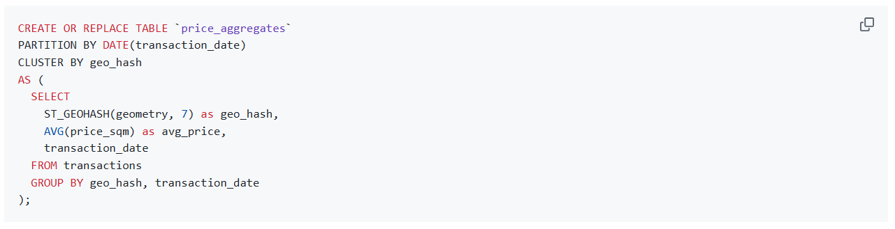
Processing Layer (BigQuery)
- Spatial clustering and aggregation
- Price evolution calculations
- Statistical validation
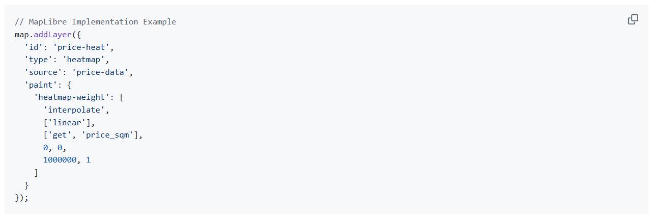
Visualization Layer (MapLibre)
- Interactive heat maps
- Temporal analysis
- Custom styling for different zoom levels

Technical Stack
Core Technologies
- BigQuery: Spatial data processing and analysis
- MapLibre GL JS: Interactive mapping and visualization
- Cloud Functions: Real-time data processing
- Cloud Storage: Tile storage and serving
Key Features
Results and Impact
Quantitative Metrics
- Coverage: 95% of French territory
- Accuracy: ±3% margin of error
- Response Time: <100ms for price calculations
- Data Points: >1M transactions processed
Business Value
For Users
- Precise location-based price evolution
- Historical trends analysis
- Investment opportunity identification
For Real Estate Professionals
- Market analysis tools
- Valuation assistance
- Trend predictions
Future Developments
Planned Enhancements
- Machine learning price prediction models
- Additional data source integration
- API access for professional users
- Mobile application development
Technical Challenges Solved
1. Data Sparsity
- Implementation of adaptive spatial clustering
- Statistical interpolation for low-density areas
- Confidence interval calculations
2. Performance Optimization
3. Real-time Processing
- Incremental updates
- Cached tile generation
- Dynamic recalculation triggers
Conclusion
ZeroImmo demonstrates the power of combining advanced spatial analysis with big data processing to solve real-world challenges in the real estate market. The project’s success lies in its ability to balance technical innovation with practical utility, delivering accurate and actionable insights to users.
Technologies: BigQuery, MapLibre, Cloud Functions, Spatial Analysis